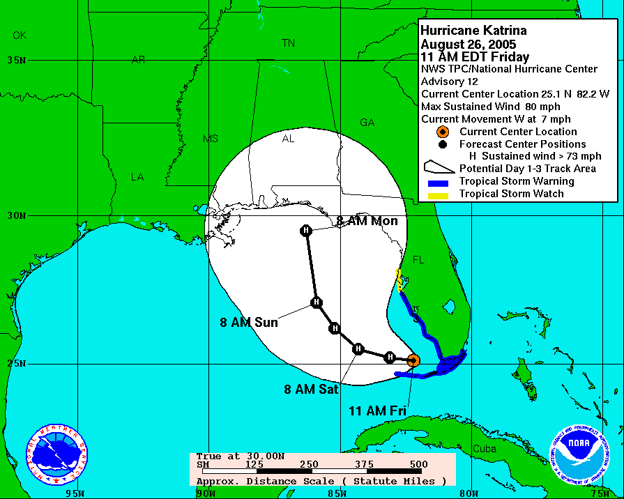
The 11 a.m. EDT update on Hurricane Katrina predicts the storm will soon reach Category 2 status with sustained winds of 96-110 mph. It also confirms the projected path has moved farther west from Apalachicola, once again, putting Pensacola near the bullseye.
Things could change -- and likely will. The NHC erred yesterday in predicting Katrina would slowly march across Broward County (Ft. Lauderdale) in crossing the southern tip of Florida. Instead, she hit farther south in Dade County (North Miami) and progressed fairly rapidly over the Everglades while crossing the Florida peninsula. Instead of losing strength over land, the storm actually gained power.
At 11 a.m. EDT Friday, NHC officially inched its 3-day path projection westward, again. It now targets an area nearer Destin. Unofficially, NHC weather pronosticators are being quoted on radio as predicting Hurricane Katrina will be at least a category 3 storm when it makes landfall.
Locally, everybody one encounters seems instantly aware of the latest weather news and nuanced variations in the forecasts. No one is taking any chances. Vehicles are gassing up, the aisles of hardware stores are filled with shoppers, bottled water is flying off grocery shelves.
As you can see in their eyes, the drill is all too familiar to panhandle residents.


No comments:
Post a Comment