"Polonius: 'O dear Ophelia, I am ill at these numbers"
-- Hamlet, Act II, Sc. II
The Wilmington (N.C.) Star is reporting a mandatory evacuation has been ordered for "all residents living in low-lying areas, wind-prone areas and mobile and manufactured homes" in Brunswick County and "the towns of Caswell Beach, Oak Island and Sunset Beach.... [and] for the southern end of Topsail Beach, from Hines Avenue southward."
A curfew has been declared for the evacuation areas beginning at 8 p.m. Wednesday "until further notice."
The paper also reports that local emergency management officials expect "near-hurricane-force winds... in the area by 5 a.m. Wednesday." The slow-moving storm is expected to "remain in the area until Thursday morning."
According to local emergency officials, Ophelia's landfall "is expected in the Morehead City area, but hurricane-force winds will be felt throughout New Hanover County Wednesday afternoon."
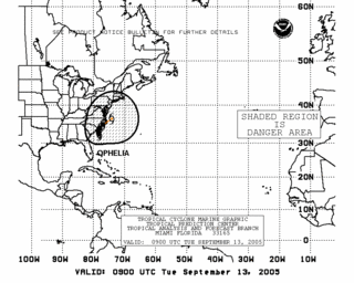
Early Tuesday morning Ophelia was located about 145 miles south of Wilmington, N.C., and 140 miles east of Charleston, S.C., confirming it has barely moved in two days. The storm is moving north-northwest at the snail's pace of 4 mph on a route that the National Hurricane Center's computer models forecast would have Ophelia "near Cape Fear in 30-36 hr."
Tropical force winds extend 160 miles from the center. According to the NHC Public Advisory, sustained winds "are near 70 MPH... with higher gusts," leaving Ophelia just below hurricane strength. But "some slow strengthening is forecast during the next 24 hours."
The NHC also says the slow-moving storm
IS EXPECTED TO PRODUCE TOTAL RAINFALL ACCUMULATIONS OF 6 TO 10 INCHES OVER FAR NORTHEASTERN SOUTH CAROLINA AND EASTERN NORTH CAROLINA...WITH POSSIBLE ISOLATED MAXIMUM RAINFALL AMOUNTS OF 15 INCHES OVER EASTERN NORTH CAROLINA.


No comments:
Post a Comment