As of 11 am EDT Monday, the National Hurricane Center still estimates the chances of Rita passing within 65 nautical miles of Pensacola in the next four days at only 7%. But the forecasting models are showing a more northward shift.
Current NHC findings include --
- Rita is strengthening and developing a "substantial inner core convection for the first time";
- The storm is moving north-northwest at 10 mph;
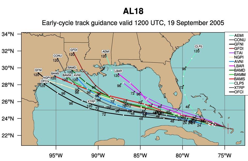
- "Most of the models have shifted farther north late in the forecast period over the western Gulf of Mexico;
- "the size of the storm is increasing";
- Conditions are conducive for further strengthening -- and "an expanding system";
- "All indications are that Rita will become a major hurricane over the Gulf of Mexico."
The consensus modeling forecasts for eventual landfall still target South Texas or the Mexican coastal state of Tamaulipas late this week.


No comments:
Post a Comment